

All-In-One Offline Maps
Category : Maps & NavigationVersion: 3.15d
Size:7.2 MBOS : Android 2.1+
Developer:Psyberia
 Download
 OfflineMaps provides you with an extensive selection of maps, ensuring you have the tools you need for all your adventures!
No advertisements ~ No data sharing & monetization ~ No analytics ~ No third party libraries
Tired of waiting for maps to load? With All-In-One OfflineMaps, once the maps are displayed, they are saved and remain accessible instantly, even without an internet connection.
• Looking for more than just roads on your maps? You'll find everything you need right here;
• Frequenting areas with poor network coverage? All your maps will remain available;
• Traveling abroad? You'll never be lost again;
• Concerned about data limits? This app will help reduce your data usage.
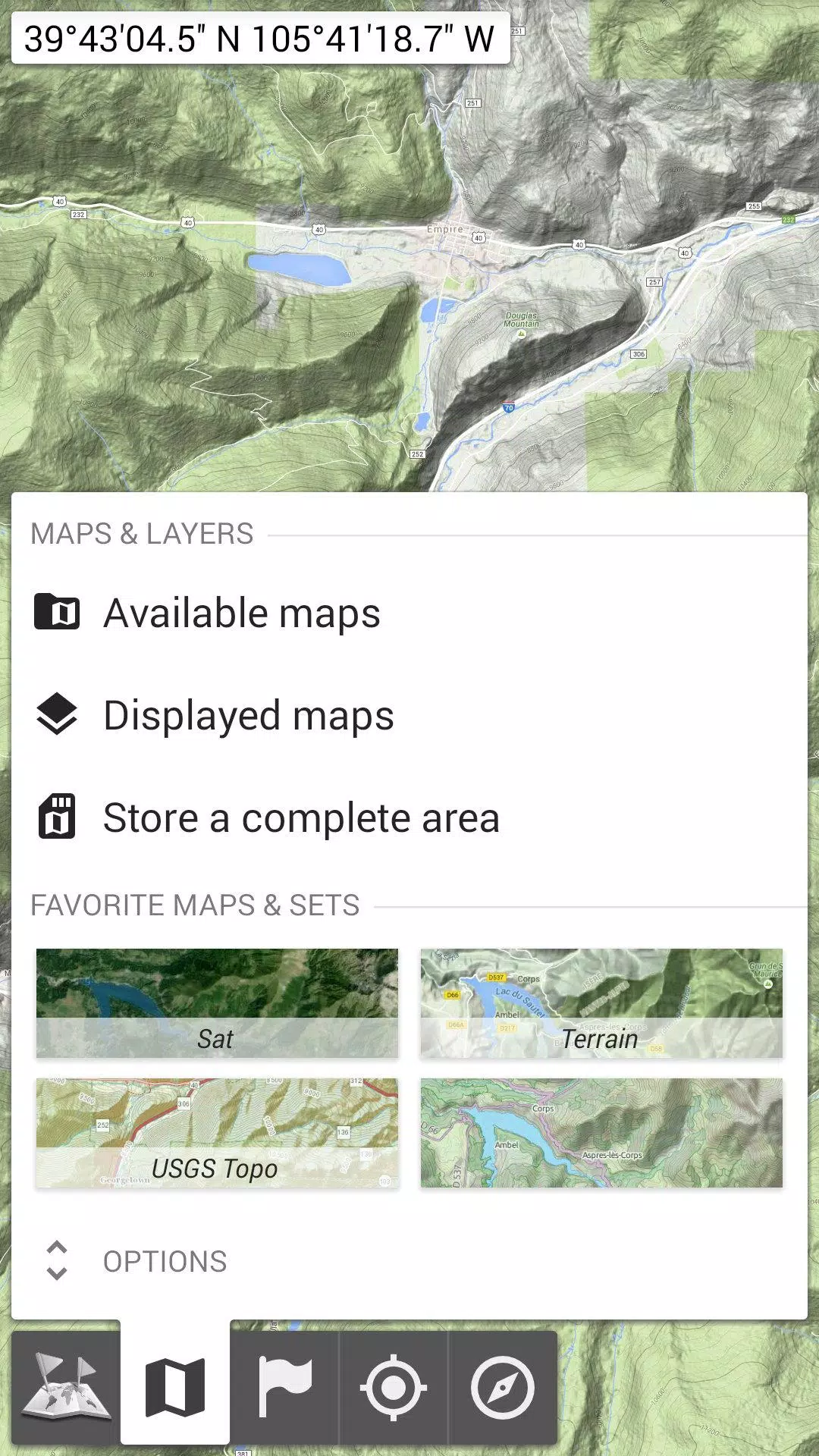
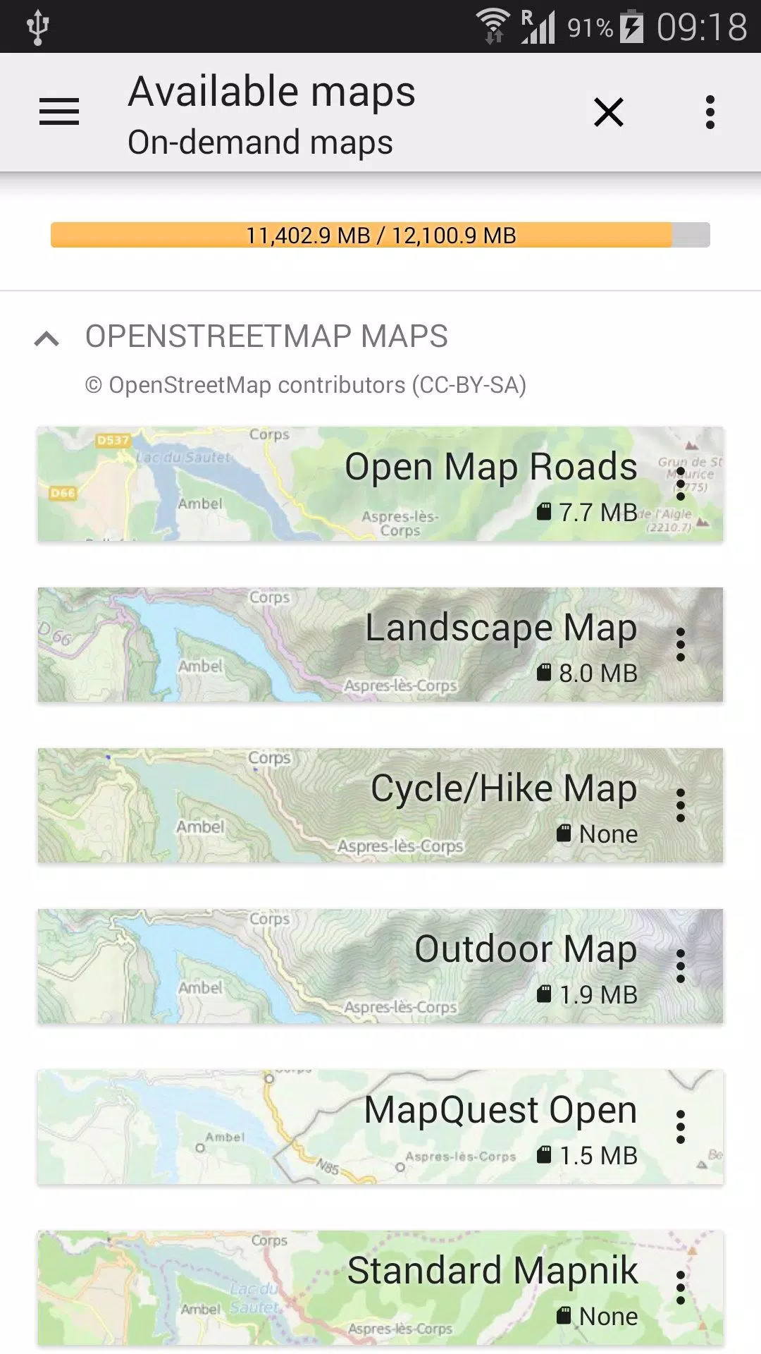
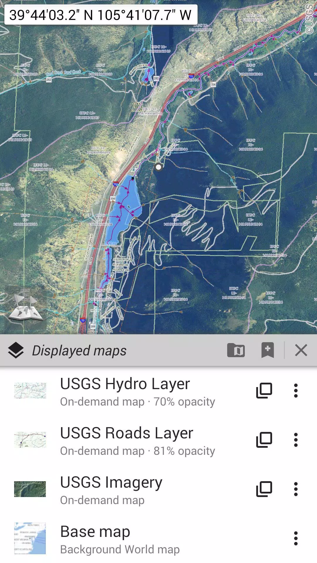
★★ Maps ★★
A vast array of maps is at your disposal, including traditional road maps, topographic maps, aerial (satellite) maps, and various overlay layers: OpenStreetMap (Roads, Topo), USGS National Map (High-resolution topo, Aerial imagery), Worldwide Military Soviet topo maps, and more.
• Maps can be layered with precise opacity control;
• Easily select and store large areas with just a few clicks;
• Stored data is organized and can be deleted effortlessly.
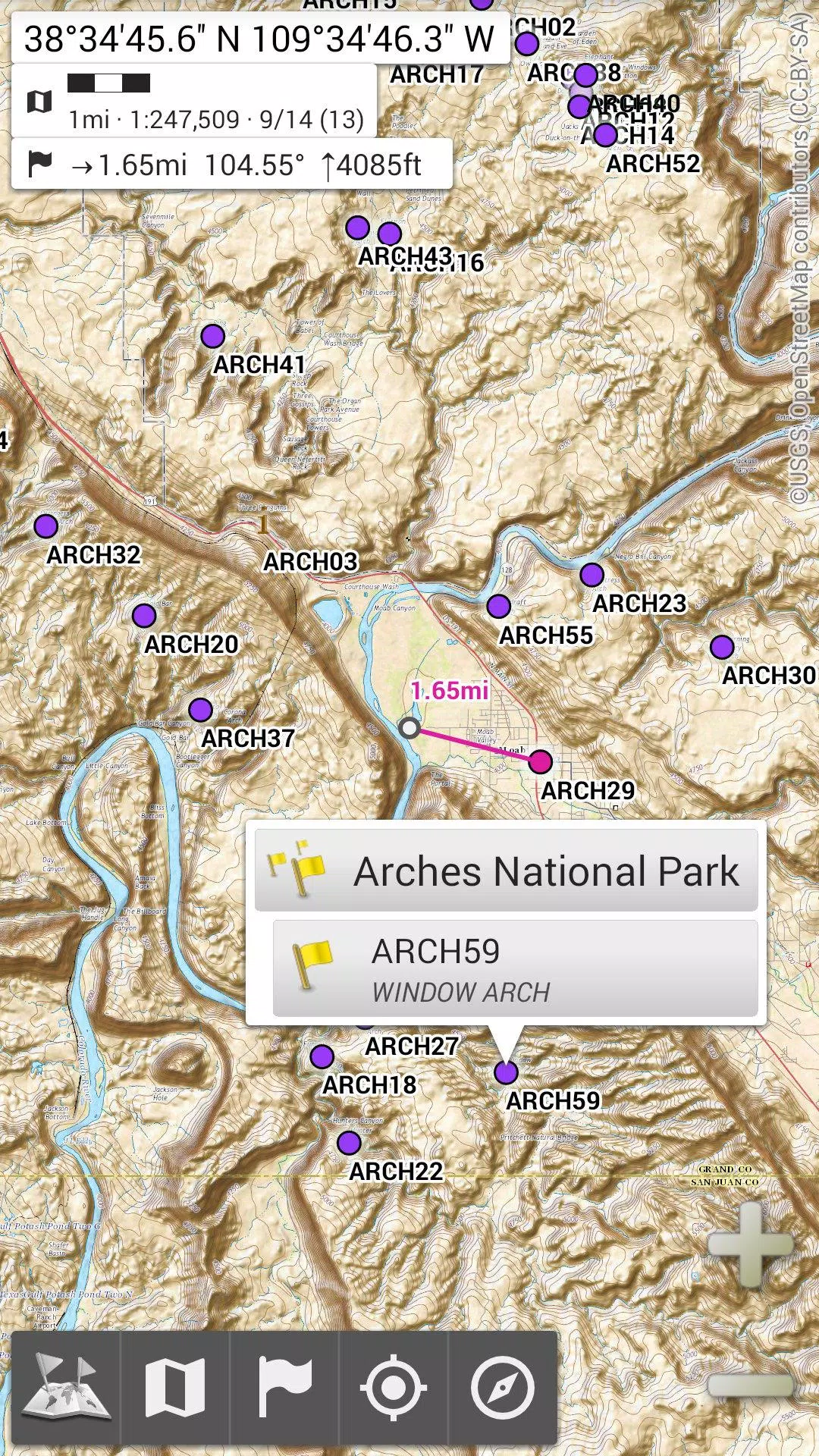
★★ Display, Store, and Retrieve Unlimited Placemarks ★★
You can add a variety of items to the map such as waypoints, icons, routes, areas, and tracks.
Effortlessly manage these using the robust SD-Card Placemarks Explorer.
★★ On-Map GPS Location & Orientation ★★
Your actual location and direction are clearly shown on the map, which can be rotated to align with your real-world orientation (device capabilities permitting).
Toggle on/off to conserve battery life.
Additional Features Include:
• Metric, imperial, and hybrid distance units;
• GPS Latitude/Longitude and various grid coordinate formats (UTM, MGRS, USNG, OSGB Grid, Irish Grid, Swiss Grid, Lambert Grids, DFCI Grid, QTH Maidenhead Locator System, ...);
• Import capability for hundreds of coordinate formats from https://www.spatialreference.org;
• On-map grid display;
• Full screen map view;
• Multi-touch zoom;
• ...
★★ Need More? ★★
For the ultimate adventurer, explore AlpineQuest Off-Road Explorer, the comprehensive outdoor solution built on All-In-One OfflineMaps, featuring a powerful GPS Track Recorder and more: https://www.alpinequest.net/google-play


-
 Top-Rated Simulation Games for PC and Mobile
A total of 10 World Bus Driving Simulator Hamster Cake Factory School Cafeteria Simulator Ship Simulator 2022 City Bus Simulator - Eastwood SimCity Real City JCB Construction 3D Public Transport Simulator 2 Supermart 3D Store Simulator Train Simulator: subway, metro
-
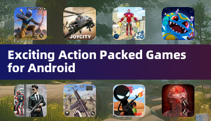 Exciting Action Packed Games for Android
A total of 10 Ninja Assassin Creed Samurai Gun Games 3D : Shooting Games Iron Hero: Superhero Fight 3D Battle Showdown: Gambit GUNSHIP BATTLE: Helicopter 3D The Walking Zombie 2: Shooter Agent Hunt Shooting Games 3D StickMan HOUSE 314: Survival Horror FPS Agent Shooting- FPS Shooter 3D

- DC Dark Legion: Harley Quinn Hero Guide 2 days ago
- Fortnite Update Adds Jukebox, New Locations 4 days ago
- SpongeBob Game Adds Endless Mode, Crossover Events 1 weeks ago
- Armored Frontline: Warzone is a tank battler that has opened global pre-registration ahead of launch 1 weeks ago
- Will Smith Reveals He Rejected Christopher Nolan's Inception: 'I Don't Think I've Ever Even Said It Publicly Before' 1 weeks ago
- Zelda Speedrun Nears 10 Minutes on Switch 2 2 weeks ago
- Pokémon Go Raid Day: Master Sparring Partners 2 weeks ago
- Chrono Agents: Time-Travel Edutainment Adventure 2 weeks ago
- Mattel Unveils Top Toy Line in New Collaboration 2 weeks ago
-

Tools / 4.1 / by The Appschef / 14.00M
Download -

Art & Design / 10.0.2 / by Team Scarface / 26.0 MB
Download -

Finance / 2.0.4 / by Bank Asia Limited / 41.00M
Download -

Auto & Vehicles / 3.34.0 / by CARFAX, Inc / 53.1 MB
Download -

Lifestyle / v1.3.9.d / by BanApp Entertainment / 21.18M
Download -

Tools / 1.4.2 / by Zeehik IT Zon / 4.72M
Download


-
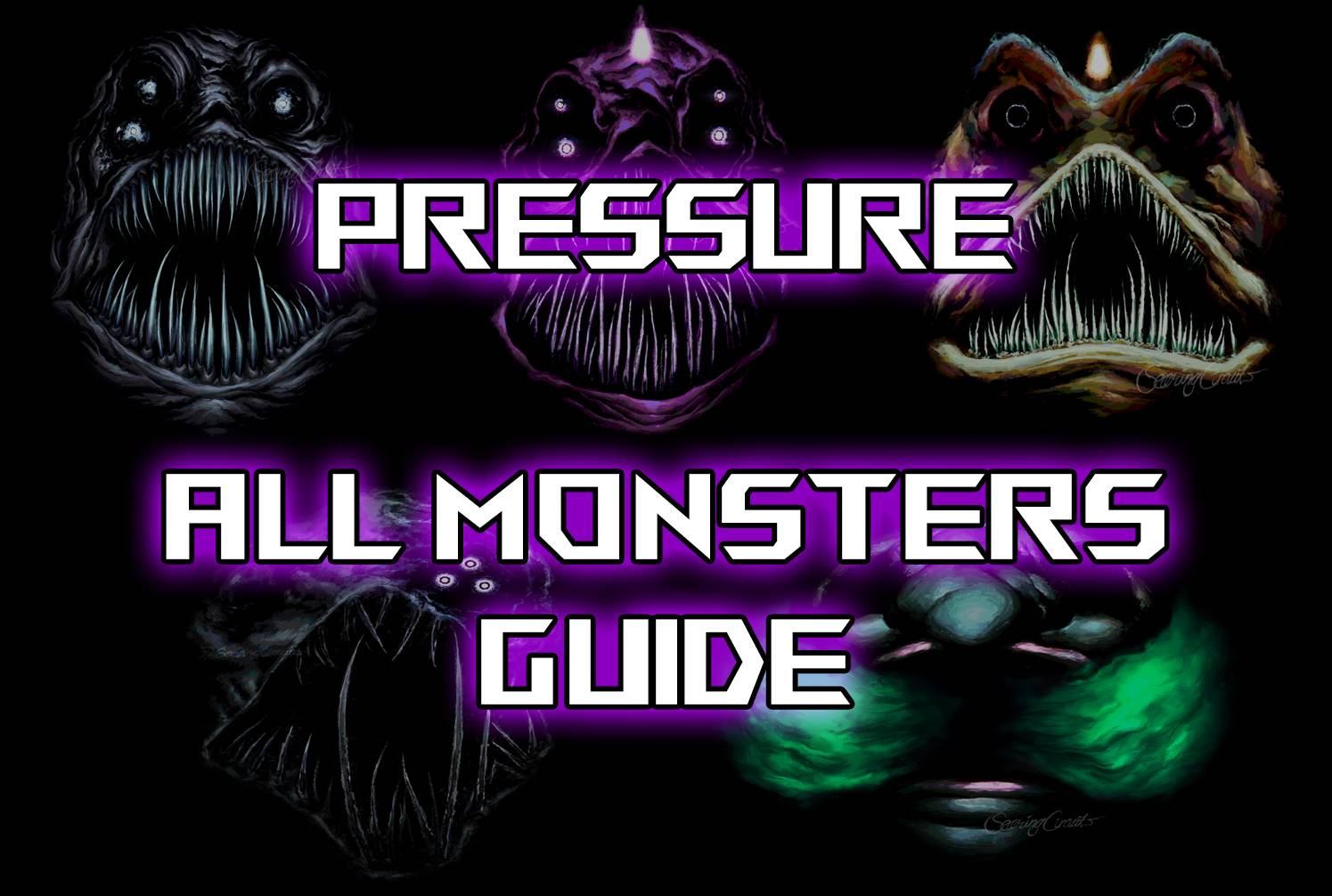 All Monsters in Pressure And How to Survive Them – Roblox
-
 "Discover All Templar Locations in Assassin’s Creed Shadows - Spoiler Alert"
-
 ETE Chronicle:Re JP Server Pre-Registration Opens With A Very Different Game
-
 "Lisa: The Painful & Joyful Surprise Android Release"
-
 Why Call of Duty: Black Ops 6 Looks Grainy & Blurry
-
 Unlocking the Secret Shop in R.E.P.O.: A Guide