

AlpineQuest Explorer Lite
Category : Travel & LocalVersion: 2.3.8d
Size:8.0 MBOS : Android 2.1+
Developer:Psyberia
 Download
 Transform your smartphone into a robust off-road GPS navigator with AlpineQuest, utilizing offline topographic maps to guide you through your adventures!
No ads ~ No data sharing & monetization ~ No analytics ~ No third-party libraries
AlpineQuest stands as the ultimate companion for all outdoor enthusiasts, catering to activities such as hiking, running, trailing, hunting, sailing, geocaching, and off-road navigation among others.
With the ability to download and store a vast array of online topographic maps locally, these maps remain accessible even when you're out of cellular range. Additionally, AlpineQuest supports a variety of on-board file-based raster map formats.
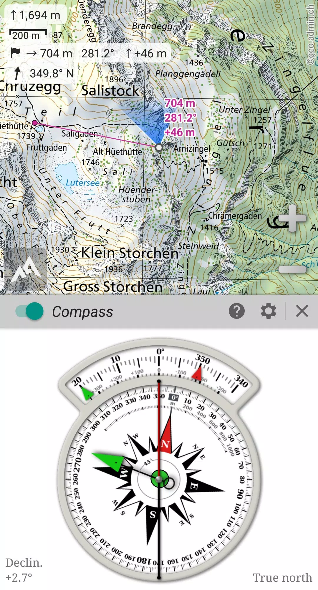
Leveraging your device's GPS and magnetic sensor, coupled with a compass display, real-time positioning on the map ensures you'll never lose your way. The map can also orient itself to align with your current viewpoint.
Save, manage, and share an unlimited number of placemarks with your friends. Track your journey, access advanced statistics, and view interactive graphics to enhance your outdoor experience.
AlpineQuest remains fully functional even without cell coverage, making it an ideal tool for exploring remote wilderness areas.
Try the Lite version for free now!
For any suggestions or issues, please use our dedicated forum at https://www.alpinequest.net/forum (no registration required, all questions answered) instead of the comments section.
Key features (available in the full version) include:
★★ Maps ★★
• Access built-in online maps (automatically stored locally; includes road, topo, and satellite maps) and online layers (e.g., road names, hillshade, contours);
• Easily access more online maps and layers from our community maps list, covering major worldwide and local topo maps;
• Store entire map areas offline for use without internet;
• Support for on-board offline maps (raster) such as KMZ Overlays, OziExplorer OZFx2, OZFx3 (partial support), calibrated images, GeoTiff, GeoPackage GeoPkg, MbTile, SqliteDB, and TMS zipped tiles. Visit our website for MOBAC, the free map creator;
• Compatibility with QuickChart Memory Map (.qct maps only, .qc3 maps not supported);
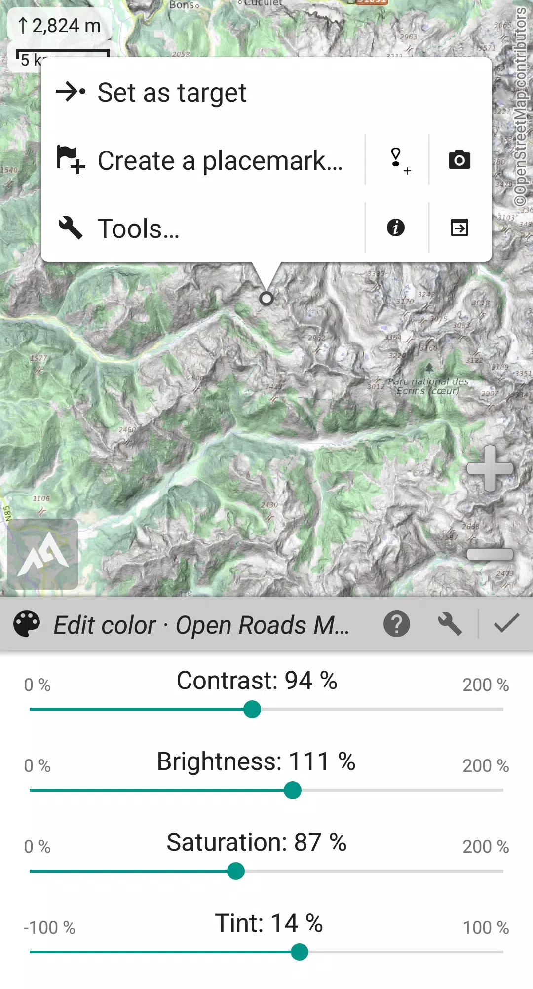
• An image calibration tool to transform any scan or picture into a usable map;
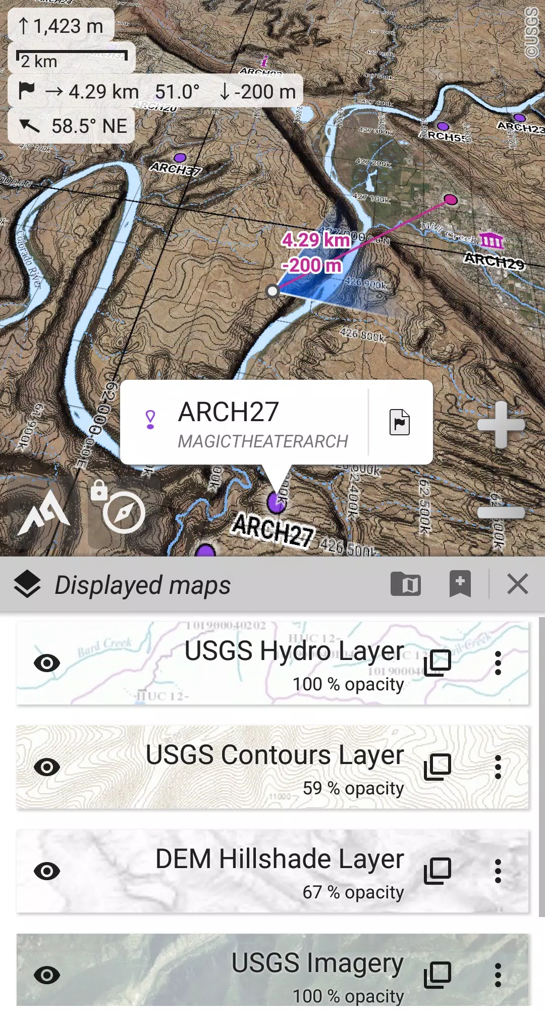
• Digital elevation model storage (1-arcsec SRTM DEM) and support for HGT elevation files (both 1-arcsec and 3-arcsec resolutions), enabling visualization of terrain, hillshade, and steep slopes;
• Polar maps (Arctic and Antarctic) support;
• Display multiple maps in layers with individual control over opacity, contrast, color, tint, and blending.
★★ Placemarks ★★
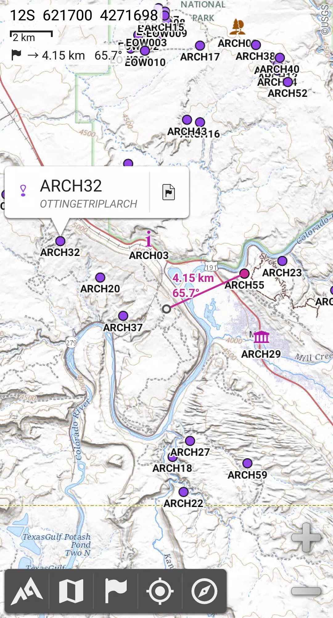
• Create, view, save, and retrieve an unlimited number of items including waypoints, routes, areas, and tracks;
• Import and export GPX files, Google Earth KML/KMZ files, and CSV/TSV files;
• Import ShapeFile SHP/PRJ/DBF, OziExplorer WPT/PLT, GeoJSON, IGC tracks, Geocaching LOC waypoints, and export AutoCAD DXF files;
• Save and share locations online with other users through Community Placemarks;
• Access details, advanced statistics, and interactive graphics for various items;
• Utilize the Time Controller to replay time-tagged tracks.
★★ GNSS Position / Orientation ★★
• Real-time geolocation on the map using your device's GNSS receivers (GPS/Glonass/Galileo/…) or Network;
• Map orientation with compass and target finder;
• Built-in GNSS/Barometric track recorder (suitable for long tracking, running in a separate and lightweight process) with battery level and network strength logging;
• Proximity and leave path alerts;
• Barometer support for compatible devices.
★★ Additional Features ★★
• Choose from metric, imperial, nautical, and hybrid distance units;
• Use Latitude/Longitude and grid coordinate formats (WGS, UTM, MGRS, USNG, OSGB, SK42, Lambert, QTH, …) with on-map grids display;
• Import numerous coordinate formats from https://www.spatialreference.org;
• ...
What's New in Version 2.3.8d
Last updated on Aug 14, 2024
2.3.8b/c/d
• New setting to customize the display style and side of the menu bar;
• Enhanced support for recent Android versions;
• Improved backup and restore functionality;
• Updated default URL for sharing coordinates as text;
• Option to set the application “Media” folder as default for placemarks, icons, pictures, and file-based maps;
• Added Croatian and Persian language support;
• Various enhancements and bug fixes.


-
 Top-Rated Simulation Games for PC and Mobile
A total of 10 World Bus Driving Simulator Hamster Cake Factory School Cafeteria Simulator Ship Simulator 2022 City Bus Simulator - Eastwood SimCity Real City JCB Construction 3D Public Transport Simulator 2 Supermart 3D Store Simulator Train Simulator: subway, metro
-
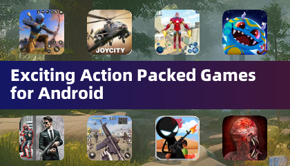 Exciting Action Packed Games for Android
A total of 10 Ninja Assassin Creed Samurai Gun Games 3D : Shooting Games Iron Hero: Superhero Fight 3D Battle Showdown: Gambit GUNSHIP BATTLE: Helicopter 3D The Walking Zombie 2: Shooter Agent Hunt Shooting Games 3D StickMan HOUSE 314: Survival Horror FPS Agent Shooting- FPS Shooter 3D


- Chrono Agents: Time-Travel Edutainment Adventure 1 weeks ago
- Mattel Unveils Top Toy Line in New Collaboration 1 weeks ago
- SpongeBob TD Codes Unveiled for March 2025 1 weeks ago
- Disney's Realm Breakers Soft-Launches in Select Regions 2 weeks ago
- Surprise Lords of the Fallen 2.5 Update Available Now, Just Hours Ahead of Sequel's Big Game Awards Showing 3 weeks ago
- Umamusume: Pretty Derby Expands Worldwide 1 months ago
-

Tools / 4.1 / by The Appschef / 14.00M
Download -

Art & Design / 10.0.2 / by Team Scarface / 26.0 MB
Download -

Finance / 2.0.4 / by Bank Asia Limited / 41.00M
Download -

Auto & Vehicles / 3.34.0 / by CARFAX, Inc / 53.1 MB
Download -

Lifestyle / v1.3.9.d / by BanApp Entertainment / 21.18M
Download -

Tools / 1.4.2 / by Zeehik IT Zon / 4.72M
Download


-
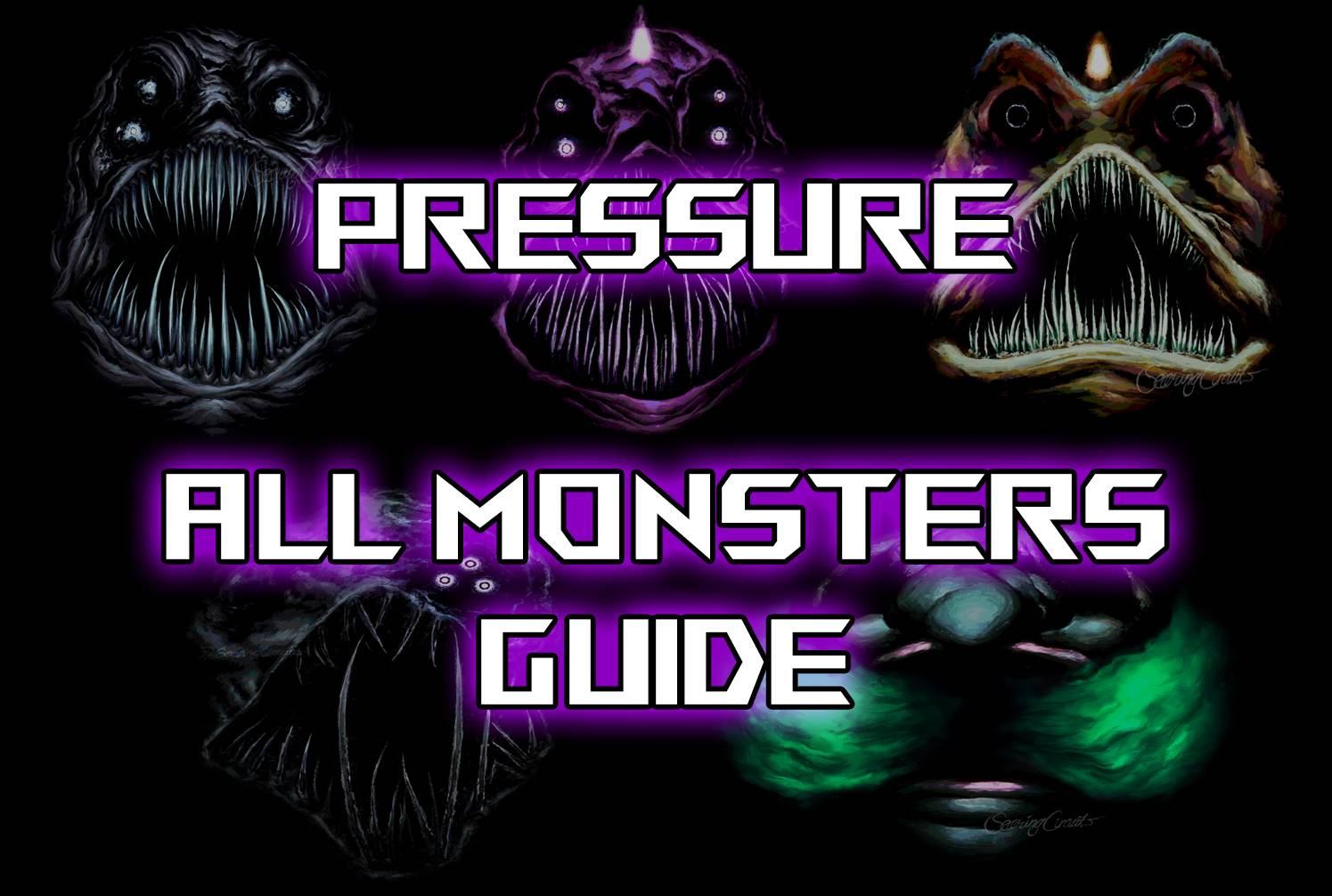 All Monsters in Pressure And How to Survive Them – Roblox
-
 "Discover All Templar Locations in Assassin’s Creed Shadows - Spoiler Alert"
-
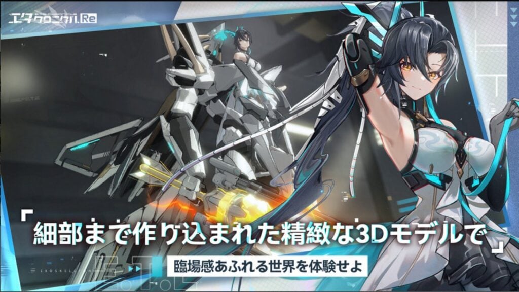 ETE Chronicle:Re JP Server Pre-Registration Opens With A Very Different Game
-
 "Lisa: The Painful & Joyful Surprise Android Release"
-
 Why Call of Duty: Black Ops 6 Looks Grainy & Blurry
-
 Unlocking the Secret Shop in R.E.P.O.: A Guide